
BAE Systems Digital Intelligence has come up with a versatile solution that streamlines the obtention of intelligence, surveillance and reconnaissance (ISR) data.
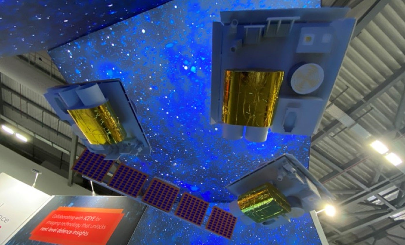
Known as “Azalea”, a cluster of four multi-sensor satellites collect optical, radar and radio frequency (RF) data that is then analysed in orbit using machine learning (ML).
Go deeper with GlobalData

Discover B2B Marketing That Performs
Combine business intelligence and editorial excellence to reach engaged professionals across 36 leading media platforms.
Azalea is the result of 25 years of space experience, with the company drawing on its telemetry tracking control processing – which provides the connection between a satellite and its ground-based facilities – for the European Space Agency (ESA).
Unlike conventional, single-purpose satellites, the cluster can be fully reconfigured whilst in orbit in the same way a smartphone installs a new app. This delivers versatile capabilities for missions and expands the lifecycle of the satellites.
Initially planned to launch into space in 2024, the high demand for launches has moved this to early 2025.
The programme supports the UK government’s Defence Space Strategy, published last year, which named Earth observation as a priority area to help protect and defend UK interests.
Showcasing the concept at Space-Comm, John Young, head of strategic campaigns, told Airforce Technology about how this solution offers military intelligence services critical insight into adversarial activity with little to no additional support.
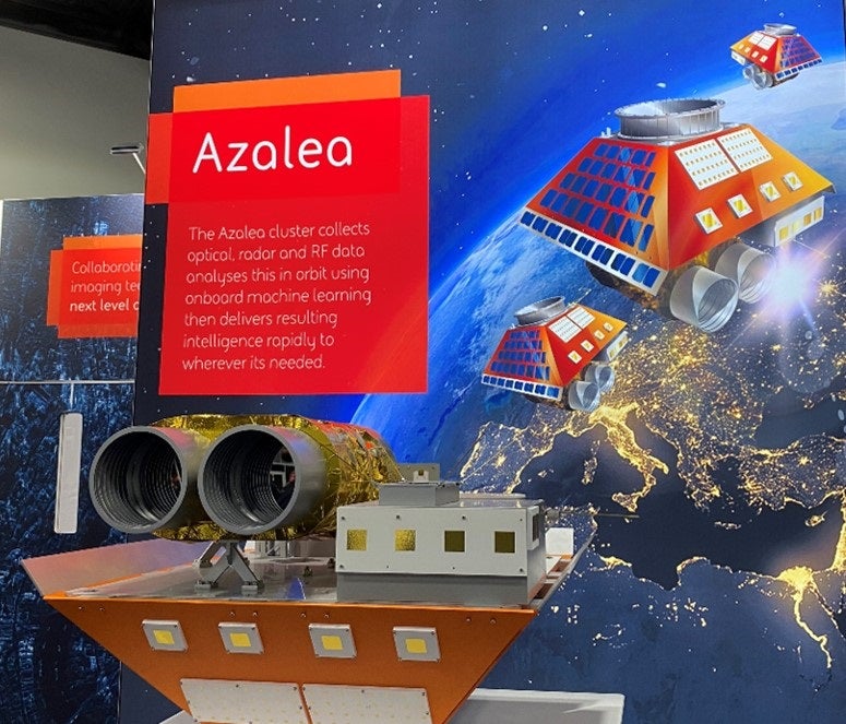
Azalea multi-sensors
“At the moment most people fire one satellite, it does one thing and delivers a load of data, and the reason we’re going for four is that it’s multi-centre.
“So you’ve got a satellite; you’ve got optical; you’ve got RF; you’ve got near infrared and you’ve got lots of things on there, but the important part is the payload, so suddenly you start putting in a software defined payload.”
Interpreting data
Many in the space industry expect artificial intellligence to be a major disruptor in the future. But already, BAE Systems has adapted ML to Azalea in order to process ISR data.
“So you’re going from collect to decide using ML techniques and that’s absolutely fundamental.
“Say that we can see a tank, instead of sending that data down now and having an analyst filter through it until they find the tank, we can get SAR [synthetic aperture radar] to trigger an optical picture of that tank; or an RF; or a near infrared image of that tank; or we can take an RF picture of the environment to see what radio frequencies have been used.
“Now when the analyst gets the load of data on the ground, our image can see a tank. They can see it in near infraredness. The analyst will think ‘that’s cold – it’s not going anywhere and there’s no RS signature’. They then know that they don’t need to do anything.”
Interstate links
The interstate links are an important feature that makes the Azalea different from other military satellite communications (MILSATCOM). This connects the four different satellites.
Young explains the significance of this infrastructure in a hypothetical situation:
“If you’ve got an urgent mission, you can reprogramme all of [the satellites]” to determine whether to send all of the data or just an alert to investigate.
“Say, if I see a fishing vessel in this location that looks like it’s low in the water, not only do I send the data back to earth, but I send it via GEO [geostationary orbit]. So I send data and that goes out to the coast guard that says go to this location and investigate.
“So the Coast Guard goes in the knowledge that it will get the back information for it.”
