
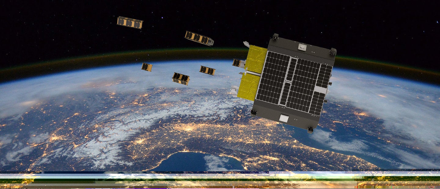
In September, the International Space Station (ISS) fired 75 thrusters at great fuel expense to avoid a piece of space debris, the 26th time it had to do so in its 20-year habitable history. And in October, two large pieces of debris travelling at a relative speed of 14.66km/s (32,800mph) narrowly avoided each other – a collision would have resulted in a catastrophic shower of debris.
The low earth orbit (LEO) in which the ISS and most military and civilian satellites reside is becoming increasingly crowded, and megaconstellation projects such as SpaceX’s Starlink are adding tens of thousands more new items every year. These join the 160 million objects already in orbit, most of which are debris, each increasing the risk of collision and loss of an essential service.
Go deeper with GlobalData

Discover B2B Marketing That Performs
Combine business intelligence and editorial excellence to reach engaged professionals across 36 leading media platforms.
The UK Space Agency (UKSA) and Ministry of Defence (MOD) announced an agreement on 16 September to collaborate on monitoring threats and hazards in space, and an award of £7m to UK companies working on projects to monitor space objects. This move recognises the fact that military and civilian interests are best served by both parties contributing to the detection and classification of space debris.
“Space is an increasingly important domain and it is vital that we collaborate with the UK Space Agency to safeguard our national security and prosperity,” an MOD spokesperson explains.“This partnership agreement will enhance space situational awareness, threat evaluations, regulation and licensing while protecting the safety and security of civil, military and commercial spacecraft.”
UKSA keeps an eye on space
UKSA head of space surveillance and tracking Jake Geer says that while space junk has been a growing problem for years, increasing reliance on satellites and the data they transmit is why people are now waking up to the hazards space debris causes.
“If you think about using a map app on your phone, or making an international phone call, or even stuff like using a cash point, all of that requires satellite data,” Geer says. “If a satellite gets hit in space by another satellite, you’re going to risk losing that data, and that can really affect how we live our everyday life.”
The project focuses on ground and space-based sensors that can examine low earth orbit, which UKSA defines as between 400km and 1,000km above the Earth.
“We’re looking at new sensors to monitor that particular environment because it’s where the UK has a lot of our investments and interests and because there are now new ways come to the market of using sensors. So typically, [using] telescopes or radars or even lasers to discover how far something is from the Earth,” says Geer.
“There are new developments in those fields, which enable new low-cost sensors to come forward. Rather than building a billion-pound radar somewhere in the Pacific, like the US military has done, there’s a lot cheaper way of doing just the space debris tracking job that we can use to support UK industry.
“It’s also a way of making sure that we have more accurate and timely data. The key thing to avoiding a collision is knowing about it ahead of time and having enough confidence in the accuracy of your data to say if I move a few hundred metres, that’s all I need to do. Because every time you do a manoeuvre in space, you waste very precious fuel, and it costs a lot of money to put a satellite up in space.”
Projects led by Lumi Space, Deimos, Lift Me Off, D-Orbit, Fujitsu, Northern Space and Security and Andor have all won funding for their space monitoring projects. Applying artificial intelligence (AI) to monitoring data is a thread running through many of them.
“Space is a data-rich environment,” Geer explains. “There are lots of different people looking at space in a variety of different ways and there are a lot of ways you can find out where space debris is and where it’s going. Trying to pull out all the information from that data and sorting the signal from the noise is very challenging sometimes, so you project AI and machine learning to help improve how we process the current data we’ve got.”
 A computer-generated image representing space debris as could be seen from high Earth orbit, showing objects in geosynchronous and low Earth orbit. Image: NASA
NORSS: a global, low-cost approach
Northern Space and Security is applying industrial research to rapidly design and deploy an extremely low-cost ground-based system using a commercially proven off-the-shelf camera system combined with a back-end processor running bespoke software.
Executive director Ralph “Dinz” Dinsley says: “At specific times of the night – usually twilight’s the best time – the camera will take pictures of the night sky and from those, we will be able to develop a light-curve frame to monitor the movement of satellites as they go through the field of view of the camera.”
The tracker information develops that into what is known as an initial orbital determination to predict the next time it will come through the field of view. That information is added to the current database of objects in space.
“It uses optical technology, rather than the more traditional radarspecifically focused at low Earth orbit. Most optical systems are focused on higher orbit–MEO [medium Earth orbit] and GEO [geostationary orbit]– because that’s what they’re better suited for,” says Dinsley.
While optical technology is cost effective, it depends on clear skies at the right time of day. Dinsley explains: “The idea is to prove the capability then deploy the system globally, and that way rather than just waiting for twilight conditions to take pictures, you’re able to catch twilight around the world and build up a more comprehensive pattern of these objects in low earth orbit.”
Lift Me Off: observation over probability
CEO Michel Poucet says: “Currently, monitoring of assets in space is done from the ground. We identify roughly where the objects are in orbit and then use probabilistic models used to say there’s a one out of 1,000 chance that these satellites will collide this moment, let us do a collision-avoidance movement.
“The way we’re looking into this is integrating sensors in space onboard a spacecraft with our algorithm so that when you’re looking around you can see an object at a distance of 50km. You can understand if that object should be there, based on the orbital position of satellites, and if it’s behaving as it should be.”
If the software flags that a satellite is not in the right position, not behaving as it should be, or looks wrong – broken or missing a solar panel, for example – the operators can flag it and trigger evasion manoeuvres if necessary.
“It makes detection more accurate because it’s not a probability; we see where it is and we know we have to get out of way,” says Poucet.
 D-Orbit’s In Orbit Now satellite carrier vessel. Credit: D-Orbit
D-Orbit: tracking debris from orbit
Lift Me Off is partnering with D-Orbit, which is using its funding to develop a capability to carry out routine, targeted space-based LEO space surveillance and tracking (SST) using its recently launched In Orbit Now (ION) satellite carrier vessel.
D-Orbit chief operating officer Simon Reid says that while space object tracking is normally done from the ground, atmospheric effects and distance limit the precision and accuracy of the readings.
“Until now, spacecraft missions to track debris on orbit have not been considered cost effective, something that may change with our proposal to extend the scope of existing ION Satellite Carrier missions in this direction,” he says. “Measurements from space can add significant value by spotting smaller objects, capturing larger objects from different angles, and helping to characterise the objects that present the most direct threat to another live spacecraft.”
ION uses a proprietary multi-purpose sensor called D-Sense which contains a camera. Eight of these are strategically placed on the spacecraft body to enable scanning of the surrounding environment. Unlike traditional star trackers, which are self-contained black box type units, D-Orbit plans to modify the software to process the images on board and capture pictures of nearby space objects.
Reid adds that, to date, most space domain awareness data for low Earth orbit has been collected by the military as a by-product of missile detection, but it is now essential to collect more and better data as the orbital environment becomes more polluted with debris.
“One curious phenomenon of debris tracking, compared to other military activities, is its transparency,” he says. “The US, the most active actor in space debris tracking, regularly notifies both allies and adversary countries about conjunctions because the effect of a collision, even one that destroys an enemy spacecraft, is global and can ultimately affect the activities of domestic satellites.
“For this reason, we believe that the more information is collected and shared in a civil context, the safer space will become for everyone. As an innovative New Space [a term for the commercialised space sector] organisation, we at D-Orbit are able to make in-orbit SST data collection very cost effective for the first time.”
 Infographic illustrating how Deimos plans to scan LEO. Image: Deimos
Deimos: scanning the sky from the UK
Deimos’s project focuses on the design, prototyping and demonstration of a low-cost LEO optical surveillance sensorthat can effectively image the entire sky from the UK. This requires a wide field of view but must be accurate enough and have sufficient resolution to see things in low Earth orbit.
“Things move really fast in low earth orbit; they’re going seven kilometres per second,” says Deimos head of space safety Emma Kerr. “To get a picture of an object in the first place, you have to have a very short exposure time. In order to do that, we’ve come up with this concept of instead of having one telescope that tries to image the entire sky, let’s have an array of telescopes that have overlapping fields of view. That we can essentially stitch together all of the images in order to image the whole sky. And so we’re looking at anywhere between five and 40 telescopes, depending on the performance that we get.”
The team will combine a charged couple device camera and a lens into a telescope. Through experimentation, they will weigh up balancing a tight field of view with a strong lens, which requires more telescopes in total and drives the cost up, with a lower-cost wider field of view with a weaker lens.
 A telescope installed at Deimos’ sky survey facility. Credit: Deimos
