

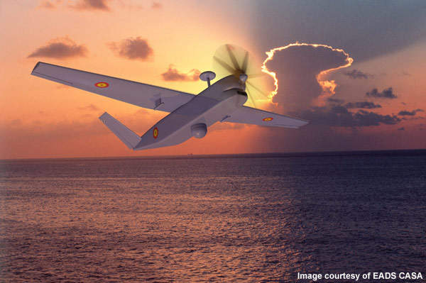


Atlante is a tactical long-endurance unmanned air vehicle (UAV) system designed by Spanish company MAS principally for the Spanish Army to perform intelligence, surveillance, target acquisition and reconnaissance (ISTAR) operations.
Recommended White Papers
Recommended Buyers Guides
Other operations carried out by the UAV include identifying target, day and night surveillance, over-the-hill reconnaissance, battle-damage assessment, troop and convoy protection, border surveillance, drug-trafficking control, and search and rescue. The UAV will also meet the requirements of the homeland security department, Guardia Civil and other Spanish emergency agencies.
The UAV system will be manufactured by EADS CASA. It will offer fully automated take-off and landing capabilities, even in adverse weather conditions.
The Atlante UAV will provide its operators with real-time information on the enemy’s battlefield by performing surveillance and target acquisition over a large area.
Atlante will perform cost and maritime surveillance, target localisation and route reconnaissance. The unmanned aerial system (UAS) of the UAV will comprise four or more vehicles, a ground-control station, a transport, launch and recovery unit, and a maintenance unit.
Atlante UAV design
The design of the UAV will offer the capability of operating 24-hours a day in any meteorological condition.
The UAV does not require take-off or landing strips, although it is provided with a landing gear system designed to operate from unprepared runways. It can operate in two modes, namely landing and take-off from runways, and can take-off from the launcher and retrieval from a parachute.
Tactical long-endurance UAV development
In December 2009, the Centre for the Development of Industrial Technology (CDTI) approved the Atlante UAV project. The UAV will be developed as part of the 2007-2012 Aeronautics Strategic Plan (ASP) of the Spanish Ministry of Industry. CDTI is financing the development of the project.
Atlante UAV features
The UAV will be configured to carry out multiple operations even in adverse weather conditions. It will employ multiple sensors and radars for extended-range data capture and transfer. It will also feature a FCC, designed and developed by the GMV, for navigation, guidance and control of the aircraft.
The FCC will comprise on-board sensors for navigation, an automatic take-off and landing (ATOL) system, actuators and a global positioning system (GPS). It will organise the automatic take-off and landing from the ground station using GPS-based navigation algorithms integrated in the navigation filter.
Atlante UAV navigation
The Atlante can be controlled either manually from the ground control station (GCS) or through an autonomous mode using an automatic launch and recovery (ALR) system. The UAV will land safely in spite of communication error in the GCS.
UAV sensors and radars
The Atlante UAV will be equipped with electro-optic (EO) and infrared (IR) sensors, and a laser designator. The EO sensor will convert light rays into electronic signals for capturing images, real-time data and videos, while the laser designator targets the enemy’s battlefield.
The UAV will be equipped with a synthetic aperture radar (SAR), intelligent and lightweight payload, and aeronautic predictive maintenance intelligent system.
Atlante UAV performance
The range and service ceiling of the aircraft is 400km and 20,000ft (6,096m) respectively. The maximum endurance is 20h. The UAV’s maximum take-off is 520kg and it can carry a maximum payload of 100kg.
Atlante ground control station
The GCS of the Atlante UAV will be manufactured by EADS CASA. The data retrieved and transmitted by the UAV will be stored at the GCS. The control station will feature a ground data terminal, a remote video terminal and a flight line tester / loader. An air data computer in the GCS will display the UAV’s position.