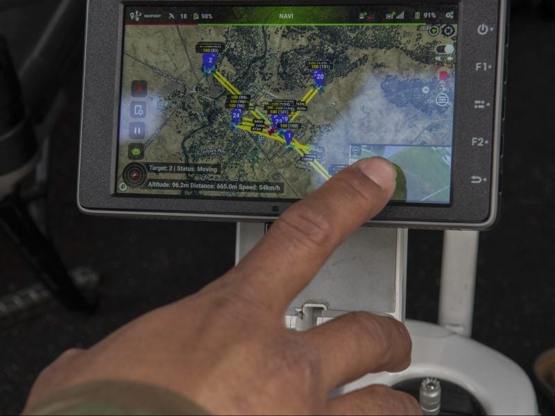
The US Air Force (USAF) has partnered with Hivemapper to turn video feeds from small drones and other sources into live 3D maps.
The system uses aerial videos to automatically create up-to-date maps which automatically highlight objects that have moved and measure the distances between points and the height of objects.
Go deeper with GlobalData

The software is being beta-tested at Beale Air Force Base in California to improve security and operational risk measures for the installation’.
USAF 9th Intelligence Squadron operations superintendent Master Sergeant Nathaniel May said: “What we are doing is taking intelligence capabilities and thinking outside the box.
“We are partnering our intelligence capabilities with other base agencies. Instead of using this ability strictly in an austere environment, we can now also use it locally to benefit home station operations.”
The testing, being undertaken in collaboration with the USAF 548th Intelligence, Surveillance and Reconnaissance Group, will assess the tool’s capabilities to map and analyse areas that are not under constant human surveillance.
How well do you really know your competitors?
Access the most comprehensive Company Profiles on the market, powered by GlobalData. Save hours of research. Gain competitive edge.

Thank you!
Your download email will arrive shortly
Not ready to buy yet? Download a free sample
We are confident about the unique quality of our Company Profiles. However, we want you to make the most beneficial decision for your business, so we offer a free sample that you can download by submitting the below form
By GlobalDataWith the tool, maps generated from video footage taken at different times can be compared to see if vehicles around the perimeter of the base have moved or if new buildings have been constructed near the base.
Currently, most mapping is done is via satellite imagery. Using drones allows for a constantly-updated picture of a military installation’s surroundings with the USAF saying the tool could help make perimeter patrols more efficient.
USAF 9th SFS innovations superintendent Master Sergeant Ajenna Smith said: “This ability could save airmen time in conducting routine perimeter security checks and also provide the ability to maintain a digital log to review later.
“This program could also show changes in terrain. For example, if a hole or tunnel is dug from the outside of the perimeter, the Hivemapper system has the ability to detect and flag those land changes.”
Hivemapper chief executive officer Ariel Seidman said: “The air force is driving the future of ISR and Hivemapper is proud to be part of that.”
The company has been working with Beale Air Force Base since 2018 to test the military applications of the mapping solution.
Seidman added: “With deployments across the air force, the Air Force Research Laboratory and Air Force Special Operations Command to name a few, the Hivemapper team continues to learn and grow with the Air Force to deliver capabilities in demand by Airmen in the field.”
Once testing is completed the USAF has said it will look to see how the system could be deployed across more facilities and bases and later possibly across the wider Department of Defence (DoD) as a whole.
Hivemapper is also working on the mapping tool with the US Special Operations Command, and the US Navy.